 Helm Boating
NOAA charts, routes that respect your draft, depth merged from four sources with the date it was surveyed, tides, currents, weather, AIS and a logbook — all working offline once your charts are downloaded.
One email when Helm is live. Free trial at launch.
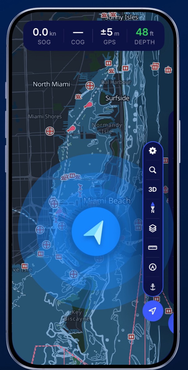
Most chart apps show a single sounding and leave the judgement to you. Helm merges four sources and tells you what is actually under your keel right now — with the date that measurement was taken.
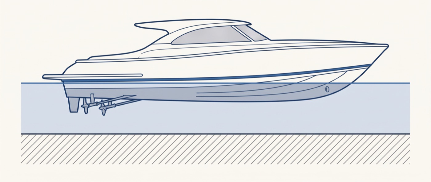
Your draft is part of the chart, not an afterthought.
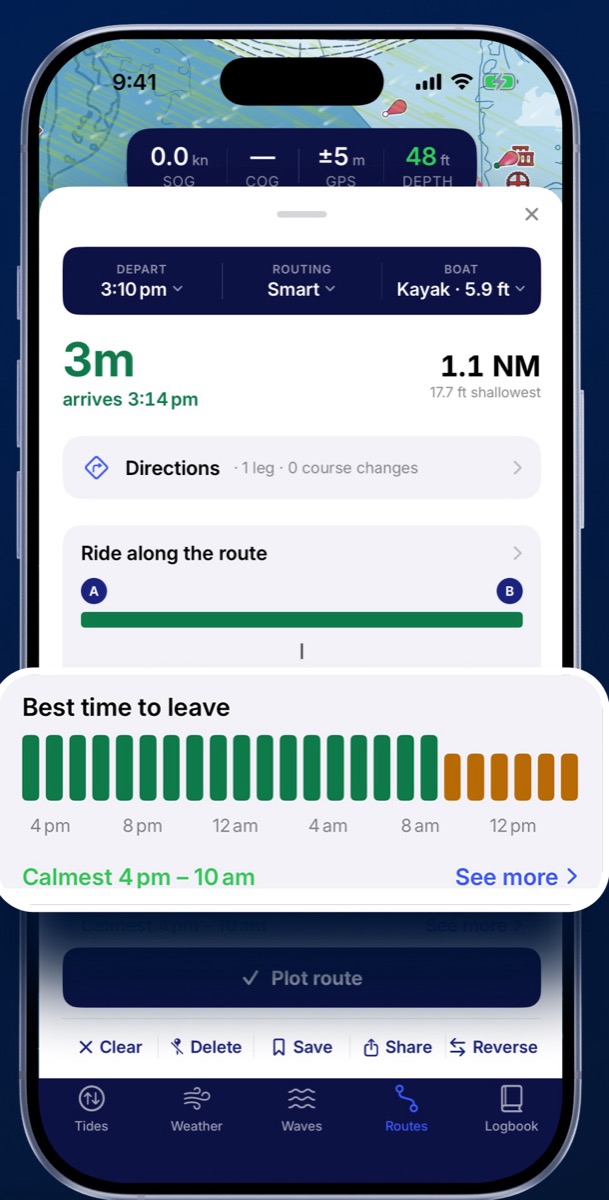
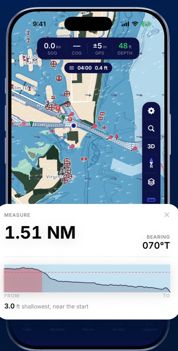
Enter your draft once. Helm plans around water that is too thin for you and shows the shallowest point on the leg before you commit. The departure planner shows when the passage is calmest, so you leave on the right tide instead of the convenient one.

NOAA CO-OPS predictions against the MLLW datum. Current arrows rotate as you scrub through the day.

Animated wind, wave and current overlays, plus a multi-day strip with gusts, air and water temperature.
Set a radius and Helm wakes you if you drag, with or without signal.
See nearby vessels on the same chart you are navigating with.
Every trip recorded and replayable, so you can get back to the same spot later.
Switch to imagery when you want the real shoreline, or a dark palette after sunset.
Coverage comes in 161 downloadable packs. Take the water you actually run and leave the rest. Once a pack is on the device, charts, routing, depth, tides and the anchor alarm all keep working with no cell service — which is the point offshore and on most lakes.
Yes. Download the chart packs for your area before you leave and the app keeps working fully offline — charts, routing, depth, tides and the anchor alarm.
No. Coastal, intracoastal, rivers and inland lakes are all covered. Lake depth comes from state elevation surveys rather than NOAA charts, which is why inland water is not a blank space in Helm.
Most render a chart and leave the depth judgement to you. Helm merges four depth sources, dates the measurement, shows the chart's own confidence rating, and plans routes around water your boat cannot cross.
Yes, natively — a real iPad layout rather than a stretched phone screen.
Yes. Save spots, read the depth contours around them and return to the same place later from your recorded trips.
Helm is built by Loop Mobile FZCO, a software company registered in Dubai, United Arab Emirates. The same company name appears on the App Store listing.